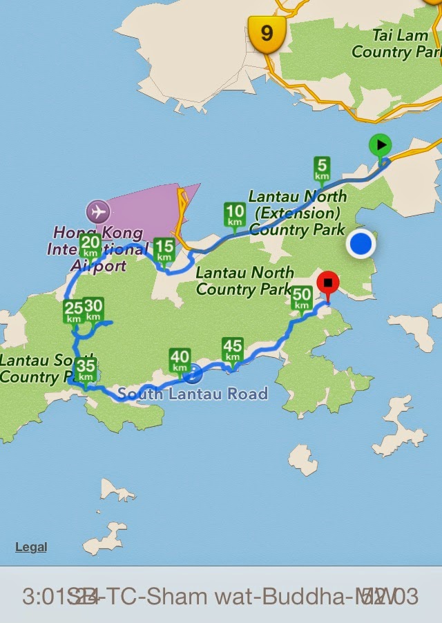
There are two ways of crossing over from South to North Lantau.
The first is the route via the Tung Chung Road, over what cyclists call 'the Beast'. (1st map)
The second is a bit more complicated and entails following the concrete footpath along the south side of Lantau opposite the airport to the village of Sham Wat, to be greeted by a very steep climb up to join the road to the Giant Buddha, about 1 Km from the Buddha. (2nd map)
 |
| The Top of the Beast is more or less at the KM25 point on this map (310m elevation). Tung Chung is Km 20, more or less at sea level. All the roads on South Lantau are shown on this map as well. |
 |
| At the top of the Beast with Brian (on right) |
See my separate blog on the South Lantau roads.
Now the alternative…..The path along the north shore opposite HK Airport is difficult to find and on the road past Yat Tung Housing Estate. It follows a concrete footpath which is very narrow and steep in places and only recommended early morning before it gets full of walkers.
 |
| The Path to Sham Wat Village is opposite the airport and concrete but very narrow and steep in places |
 |
| The Path beyond Sham Wat Village on the way to Tai O |
 |
| This is a mountain bike trail from Sham Wat Village to Tai O, with steps along the way so very slow progress in places |


