Wednesday, 9 April 2014

Lantau: Cycling from North Lantau to South Lantau - via The Beast or via Sham Wat Road


There are two ways of crossing over from South to North Lantau.  

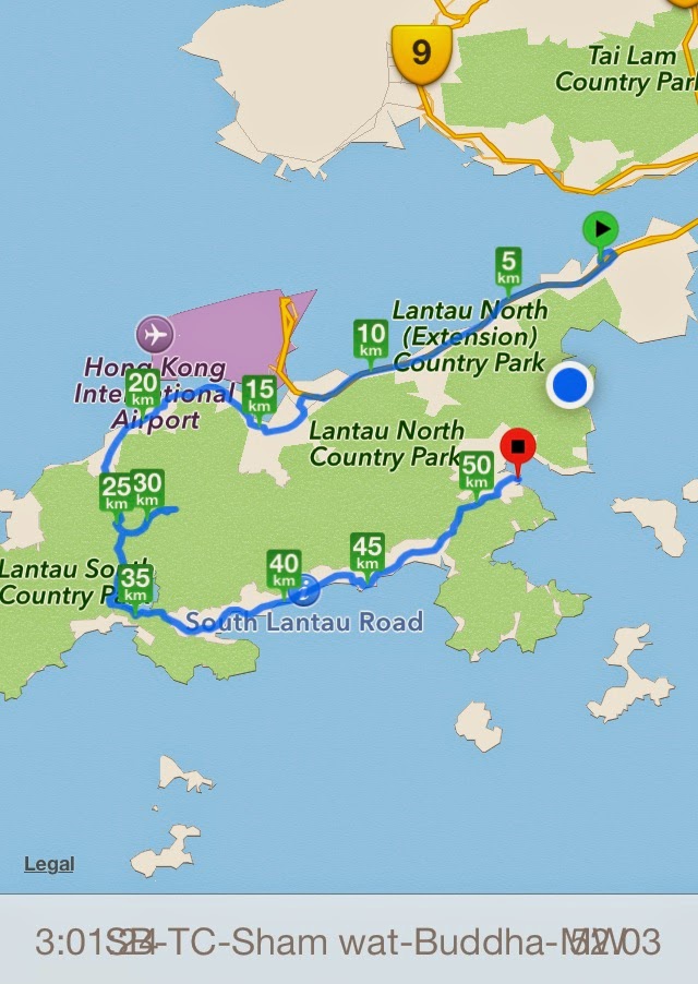
The first is the route via the Tung Chung Road, over what cyclists call 'the Beast'. (1st map)  

The second is a bit more complicated and entails following the concrete footpath along the south side of Lantau opposite the airport to the village of Sham Wat, to be greeted by a very steep climb up to join the road to the Giant Buddha, about 1 Km from the Buddha. (2nd map)


The Top of the Beast is more or less at the KM25 point on this map (310m elevation).  Tung Chung is Km 20, more or less at sea level. All the roads on South Lantau are shown on this map as well.
The Beast road is shown in the photo below - doesn't look very steep does it?  Well it is!  Always a bit daunting even after 2 years of getting better at it.  My best time on the Beast is 19 minutes 56 seconds average speed of 10.4 Km/hr. I am not the slowest.  Strava places me 200th out of 556 riders. The first time I did it 2 years ago, I walked up some of the way. 


The Tung Chung Road (the 'Beast') goes up over the central mountain ridge on Lantau between Sunset Peak and Lantau Peak. 3.4Kms of climbing up 310 vertical metres with an average grade of 9.1%. Max gradient 20.6% 

At the top of the Beast with Brian (on right) 


This is the descent to the south side of Lantau from the Beast.  Referred to as the 'Reverse Beast'.  The Water Catchment road begins at this point down some steps on the left, and is an alternative route along south of Lantau towards the Buddha.  At the bottom of this hill is the South Lantau Road, turn left for Mui Wo, and turn right for the Buddha and Tai O.

See my separate blog on the South Lantau roads.

Now the alternative…..The path along the north shore opposite HK Airport is difficult to find and on the road past Yat Tung Housing Estate.  It follows a concrete footpath which is very narrow and steep in places and only recommended early morning before it gets full of walkers.

The Sham Wat path begins in Tung Chung before KM 15, and continues to Sham Wat village around KM20.  From Sham Wat you then climb very steeply up a wider road to join the Ngong Ping Road that leads to the Buddha.  Or continue along the coast to Tai O, but it is for Mountain bikes


The Path to Sham Wat Village is opposite the airport and concrete but very narrow and steep in places


The Path beyond Sham Wat Village on the way
to Tai O 

This is a mountain bike trail from Sham Wat Village to Tai O, with steps along the way so very slow progress in places


Wednesday, 19 March 2014

Lantau: Cycling in Discovery Bay

Discovery Bay is a major residential area on the South Eastern side of Lantau Island. It has the feel of a resort, with beaches, and many waterside bars and restaurants, and leisure facilities.  It is a popular place of residence for expatriates, with a safe environment for families, and is well connected to the airport and HK Island.  The masses of tall apartment blocks, and other residential areas, are not especially attractive, but the backdrop of the Lantau mountains, and the coastal views means it is an pleasant place to cycle. 

Fast Ferries link Discovery Bay with Central,  running every 30 minutes, and buses link to the Airport, Sunny Bay and Tung Chung.  The only way to bring a bicycle is to take the ferry from Central and there is no charge. (once you have paid the HKD 37 ony passenger fare).

There is more cycling to do than you would imagine, along the main spine of the resort and dipping into the many residential roads.  There is also a very good road up the hill, past the reservoir, and on to the Golf Club. Plenty of hill climbing practice! Discovery Bay is good for cycling because the roads are smooth, and generally quiet as only Buses, Delivery Lorries and Golf Buggies are allowed.


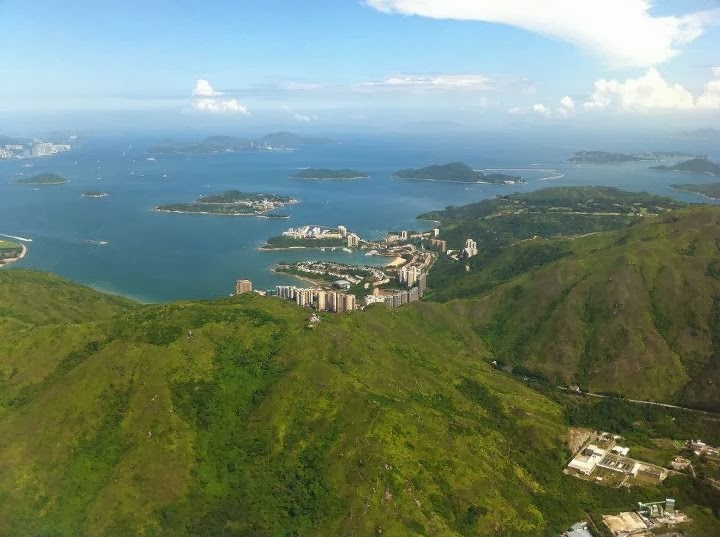
From the Air after taking off from HK International Airport

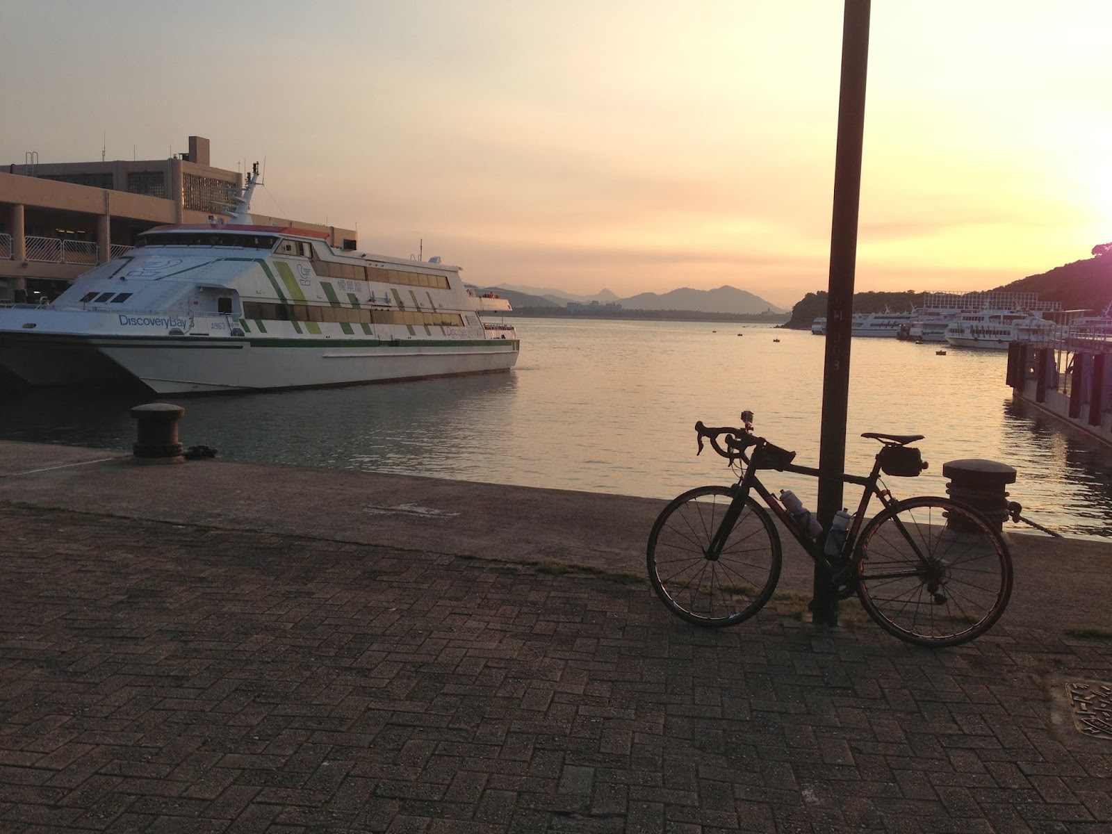
Discovery Bay Ferry Terminal


View from above Discovery Bay


View from Golf Club Road, Central Hong Kong in the distance

Discovery Bay Reservoir, with the Lantau Hills behind

Sunday, 26 January 2014

Hong Kong Island: Mount Austin / Victoria Peak Gardens (above The Peak)

Above the Peak, the road continues sharply upwards and winds steeply up to Victoria Peak Gardens, also called Mount Austin.  There is a good viewpoint over Pok Fu Lam and Lamma Island from the terrace.  


Sunday, 1 December 2013

Hong Kong New Territories: Tai Mo Shan - HK's highest Peak


I have cycled up Tai Mo Shan 12 times since I arrived in Hong Kong, 2 years ago. It is Hong Kong's highest peak (957m), and the road to the top serves the Hong Kong Observatory's weather radar station. 


Tai Mo Shan from Hong Kong Harbour
Hong Kong Harbour from Tai Mo Shan

 (Chinese大帽山pinyinDàmàoshān / Dàmào ShānCantonese: daaih mouh sāān; literally "Big Hat Mountain") 

It is open to road vehicles in the country park to half way up where there is a car park, after that there is a barrier where only cyclists and walkers can pass.  The sign at the barrier says cycles are not permitted, but the guard in the shed by the barrier has not stopped anyone so far.

It is a great ride, my favourite, for the views, for the nice quiet interesting road, and for the challenge of the slope which goes up to 16% in parts.  Very satisfying once you are fit enough to cycle up at a reasonable pace.  I remember the first time I tried it in January 2012.  Had to push my bike some of the way! 

0 to 950m in around 12 kilometres
from Tai Wo Hau MTR station in HK new territories

The usual route is to get an MTR train to Tai Wo Hau or Tsuen Wan on the Tsuen Wan Line.  I find Tau Wo Hau is easier (see route above), although you really have to cycle on the pavement from the station to the roundabout at the foot of Route Twisk; best done early morning to avoid any police. Route Twisk starts at the roundabout, and after 6.3 Kms you turn right into the country park, for the remaining 4.6 Kms to the top.

Distances/Slope:
Route Twisk Roundabout to Country Park entrance:
6.3Kms  average slope 6% Vertical metres 375
Maximum Slope 13%
Route Twisk exit to the Summit:
4.6Kms average slope 9.9% Vertical metres 456 Maximum slope 15.7%
Kiosk at entry to Tai Mo Shan Country Park with the lady who is always there

At top of Route Twisk (so called because it links Tsuen Wan on one side of the hill with Shek Kong on the other side); there is a kiosk up the road on the right (where the car is)


Near the Car Park and Barrier;
observatory visible at top
View of the road coming up to the car park

My favourite part, the series of hairpin bends near the top; need to be careful descending on a bike as the bends are tight and no barriers
View from the top 1: Tsing Yi Island on right; Kowloon on left; West side of HK Island behind

View from the top 2: Kowloon with Hong Kong Island behind

Best weather I have seen here,
very nice road for cyclists….

….and buffalos

Quite docile creatures……(us cyclists)


Dave conquers TMS for the third time

Inevitable Group photo (Mark, Nick, Ian, and Dave) in front of the HK Observatory Weather Radar Station - as the site is restricted you can't climb to the very top, about 20 vertical metres short


Nick and Osman relaxing at the top after a hard climb

Osman, Jay and Sherman 

The views on a clear day are great, you can see the whole of Hong Kong

Looking north to Tai Po and Fanling

Looking towards the Chinese border

View of Tai Po and Tolo Harbour - looking east

Another view North - towards Yuen Long

Looking South East towards the east side of HK Island

So much for today…..

Here are some photos of other days when I climbed Tai Mo Shan when the weather was not so good….


Now we know why there are white lines on the road

Heading back down from the car park
Tai Mo Shan is up there somewhere
Can still be fun when the visibility is down